Free sample report · No sign-in required
Sacramento,
California.
A closer look at the places, practical details and questions that shape a move.
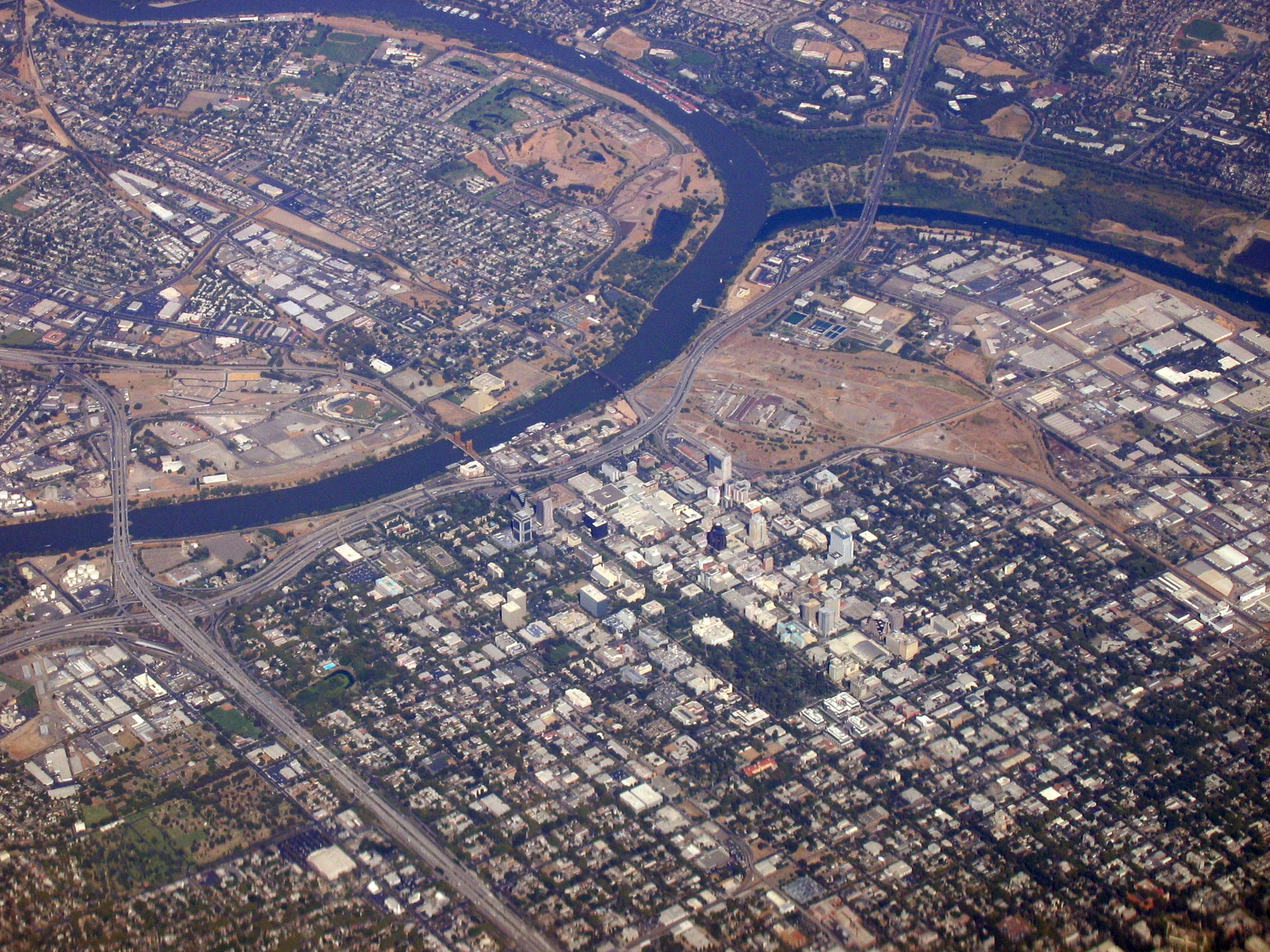
Historical photo: Ron Reiring, September 21, 2006 · Wikimedia Commons · CC BY 2.0. Not current property imagery.
The sample at a glance
Get to know Sacramento.
From riverfront outings and neighborhood parks to summer breezes and light rail connections, explore the local details that help you picture life here. This city-level sample pairs verified context with sources you can investigate further.
No home is selected. Property-specific measurements and unsupported ratings remain clearly marked as unavailable.
7
Research topics
Free
No card required
City-level
No home selected
Property & neighborhood information
A city overview, not a listing or property valuation.
- Sacramento publishes neighborhood maps for checking local boundaries. A specific property's neighborhood must be checked against its location.
- The Sacramento County Assessor provides a Parcel Viewer for looking up parcel maps and assessment records. Assessed value is not a current market valuation.
Data unavailable: home-specific prices, rent, taxes, bedrooms and condition; no property address is selected.
Assessor Parcel Viewer (opens in new tab)Sacramento County Assessor · Publication date not provided
Neighborhood maps (opens in new tab)City of Sacramento · Publication date not provided
Schools & education
School assignment starts with the exact home address.
- Sacramento City Unified School District describes geographic boundaries for neighborhood schools and provides a School Finder.
- District and attendance boundaries must be confirmed with the local district for a particular address. Being nearby does not establish eligibility.
Data unavailable: confirmed school assignment, ratings and current academic results.
Find your school (opens in new tab)Sacramento City Unified School District · Publication date not provided
Crime & safety
Official records, without unsupported safety conclusions.
- Sacramento Police provides an Open Data Portal and Community Crime Map for exploring calls and reported incidents.
- A map entry is not a neighborhood crime rate. Any comparison needs a defined boundary, reporting period and population denominator.
Data unavailable: verified neighborhood crime rates, trends and safety ratings.
Open Data Portal and Community Crime Map (opens in new tab)Sacramento Police Department · Published: June 28, 2024
Wildfire & natural hazards
Hazard maps are location-specific, not a citywide guarantee.
- CAL FIRE's Fire Hazard Severity Zone maps describe hazard, which the agency distinguishes from risk.
- Sacramento's flood maps provide FEMA flood-zone lookup and additional floodplain and levee-related maps. Check the exact location before drawing a property conclusion.
Data unavailable: a home's wildfire classification, flood zone, insurance costs and full hazard assessment.
Fire Hazard Severity Zones (opens in new tab)CAL FIRE · Office of the State Fire Marshal · Publication date not provided
Flood maps (opens in new tab)City of Sacramento · Publication date not provided
Weather & climate
Seasonal context for everyday life, from a historical NOAA reference.
- NOAA's Sacramento reference describes warm, dry summer days and a winter rainy season from November through February. In that historical reference, more than half of annual precipitation falls during those winter months.
- The NOAA reference describes summer marine air flowing through the Sacramento–San Joaquin Delta, bringing cooling breezes to the Sacramento area.
- Winter fog is part of the region's climate context. This reference was revised in June 2005; it describes historical patterns, not today's weather or future conditions.
Data unavailable: live weather, alerts, current climate normals and address-level projections.
Climate of Sacramento, California (opens in new tab)NOAA · Published: Revised June 2005
Restaurants & local amenities
Parks, art, riverfront outings and distinctive local restaurants to explore—not a ranked list.
- William McKinley Park, at 601 Alhambra Boulevard, offers a jogging trail, a rose garden, tennis courts, and swimming and wading pools, according to the City park directory.
- William Land Regional Park's City listing includes Fairytale Town, Funderland, a golf course, lakes and picnic areas. Check individual attractions directly for current access.
- Old Sacramento Waterfront highlights riverboat outings, railroad excursions, horse-drawn carriages and riverside bike rides—ideas for exploring the historic waterfront.
- Crocker Art Museum's collections include California art from the Gold Rush to the present, international ceramics, and Asian, African and Oceanic art.
- Tower Café's founder dates its opening to April 22, 1990—Earth Day—and describes opening in the former original Tower Records location.
- Frank Fat's is a downtown Sacramento restaurant whose official history dates its beginnings to 1939. These dining examples are not review ratings or claims of proximity to a home.
Data unavailable: a complete venue inventory, ratings, current hours and distances from a home. Check venues directly.
About Tower Café (opens in new tab)Tower Café · Publication date not provided
Restaurant history (opens in new tab)Frank Fat’s · Publication date not provided
Explore Old Sacramento Waterfront (opens in new tab)Old Sacramento Waterfront · Publication date not provided
About the museum and its collections (opens in new tab)Crocker Art Museum · Publication date not provided
William McKinley Park (opens in new tab)City of Sacramento · Publication date not provided
William Land Regional Park (opens in new tab)City of Sacramento · Publication date not provided
Commute & transportation
Light rail, buses and an airport connection—with schedules to check before you travel.
- SacRT lists three light rail lines: Gold (Historic Folsom–Sacramento Valley Station), Blue (Watt/I-80–Cosumnes River College), and Green (7th & Richards/Township 9–13th Street).
- SacRT publishes bus and light rail schedules alongside system maps, so you can check routes and connections for your own origin and destination.
- SacRT's Airport Express, Route 142, connects downtown Sacramento with Sacramento International Airport terminals A and B. Check the current timetable before planning a trip.
Data unavailable: door-to-door times, live traffic, walking distances and home-specific transit ratings.
System maps (opens in new tab)Sacramento Regional Transit District · Publication date not provided
Bus and light rail schedules (opens in new tab)Sacramento Regional Transit District · Publication date not provided
Transit services and Airport Express (opens in new tab)Sacramento Regional Transit District · Publication date not provided
Your next neighborhood
Make your next move
an informed one.
Find the places that fit your next chapter. Start with free neighborhood guides, then explore Basic or Pro for the research tools included in each plan. Information varies by location and source availability.